Geolocate

Colliery topographic map

Click on the map to display elevation.

About this map

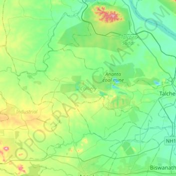
Name: Colliery topographic map, elevation, terrain.

Location: Colliery, Anugul, Odisha, India (20.90091 85.00113 21.00463 85.24541)

Average elevation: 117 m

Minimum elevation: 46 m

Maximum elevation: 327 m

Other topographic maps

Click on a map to view its topography, its elevation and its terrain.

Talcher

India > Odisha > Colliery

Average elevation: 84 m

Gear up for your next adventure:

🎒Hiking Backpacks - Comfortable backpacks for day hikes and multi-day treks
🩹Hiking First Aid Kits - Compact medical kits tailored for trail injuries and emergencies
🗺️Topographic Maps - Detailed maps showing elevation and terrain features
🧊Insulated Flasks - Keeps drinks hot or cold during hikes
🥤Hydration Bladders - Hands-free hydration systems for backpacks

As an Amazon Associate, this site earns from qualifying purchases at no extra cost to you.