
Botasi topographic map
Interactive map
Click on the map to display elevation.
About this map
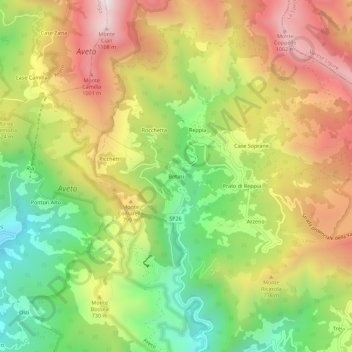
Name: Botasi topographic map, elevation, terrain.
Location: Botasi, Ne, Genua, Ligurien, Italien (44.35002 9.43504 44.39002 9.47504)
Average elevation: 651 m
Minimum elevation: 211 m
Maximum elevation: 1,123 m