
Gorafe topographic map
Interactive map
Click on the map to display elevation.
About this map
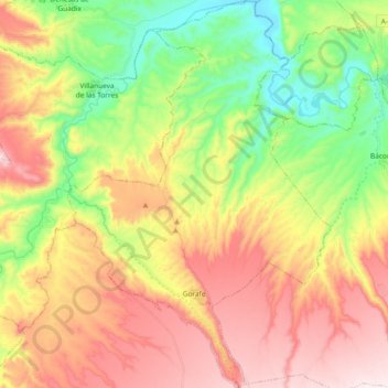
Name: Gorafe topographic map, elevation, terrain.
Location: Gorafe, Comarca de Guadix, Granada, Andalusien, 18890, Spanien (37.44342 -3.10394 37.59087 -2.97793)
Average elevation: 816 m
Minimum elevation: 543 m
Maximum elevation: 1,124 m
Other topographic maps
Click on a map to view its topography, its elevation and its terrain.
Ferreira
Spanien > Andalusien > Comarca de Guadix
Ferreira, Comarca de Guadix, Granada, Andalusien, 18513, Spanien
Average elevation: 1,359 m