
Hannam-dong topographic map
Interactive map
Click on the map to display elevation.
About this map
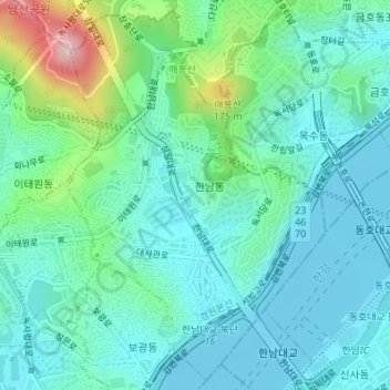
Name: Hannam-dong topographic map, elevation, terrain.
Location: Hannam-dong, Yongsan-gu, Seoul, South Korea (37.52477 126.99486 37.55039 127.01752)
Average elevation: 59 m
Minimum elevation: 4 m
Maximum elevation: 258 m
Other topographic maps
Click on a map to view its topography, its elevation and its terrain.