Geolocate

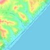
Locri topographic map

Click on the map to display elevation.

About this map

Name: Locri topographic map, elevation, terrain.

Location: Locri, Reggio Calabria, Calabria, 89044, Italy (38.20527 16.19790 38.26840 16.28209)

Average elevation: 28 m

Minimum elevation: 0 m

Maximum elevation: 329 m

Other topographic maps

Click on a map to view its topography, its elevation and its terrain.
Riace Marina

Italy > Calabria > Reggio Calabria

Average elevation: 36 m

Gear up for your next adventure:

🎒Backpack Rain Covers - Universal waterproof covers to protect your gear from downpours
🧢Waterproof Hiking Hats - Keep the rain off your face while studying topographic maps
🔥Emergency Fire Starters - Reliable ignition tools for survival situations in damp conditions
🧢Thermal Beanie Hats - Prevent heat loss from the head in windy summit conditions
🚲Bikepacking Frame Bags - Storage for tools and navigation gear on long off-road rides

As an Amazon Associate, this site earns from qualifying purchases at no extra cost to you.