
Agri topographic map
Interactive map
Click on the map to display elevation.
About this map
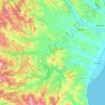
Name: Agri topographic map, elevation, terrain.
Location: Agri, PZ, BAS, 85057, Italia (40.21787 16.00109 40.31763 16.73788)
Average elevation: 420 m
Minimum elevation: -1 m
Maximum elevation: 1,718 m
Other topographic maps
Click on a map to view its topography, its elevation and its terrain.