
Bistrița topographic map
Interactive map
Click on the map to display elevation.
About this map
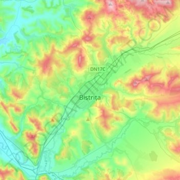
Name: Bistrița topographic map, elevation, terrain.
Location: Bistrița, Bistrița-Năsăud, Romania (47.05055 24.38651 47.22851 24.65179)
Average elevation: 429 m
Minimum elevation: 294 m
Maximum elevation: 719 m
Other topographic maps
Click on a map to view its topography, its elevation and its terrain.