Geolocate

Olney topographic map

Click on the map to display elevation.

About this map
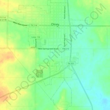
Name: Olney topographic map, elevation, terrain.

Location: Olney, Young County, Texas, 76374, United States (33.34046 -98.77693 33.37977 -98.74298)

Average elevation: 366 m

Minimum elevation: 351 m

Maximum elevation: 384 m

Other topographic maps

Click on a map to view its topography, its elevation and its terrain.
Graham

United States > Texas > Young County

Average elevation: 332 m

Gear up for your next adventure:

🦶Anti-Blister Balms - Protect your feet before long topographic expeditions
🧺Mesh Stuff Sacks - Breathable storage for wet gear or camp organization
🔦Outdoor Torches - Reliable torches for night navigation
🧭Emergency Beacons - Safety beacons for remote outdoor locations
🎒Multi-day Trekking Packs - Large capacity backpacks for wild camping and long-distance trails

As an Amazon Associate, this site earns from qualifying purchases at no extra cost to you.