
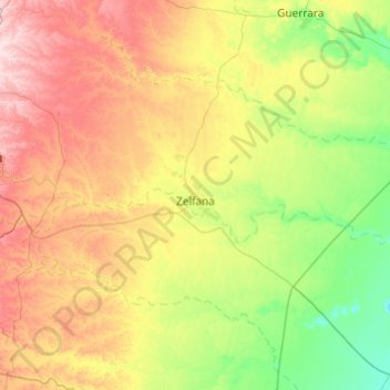
Zelfana topographic map
Interactive map
Click on the map to display elevation.
About this map
Name: Zelfana topographic map, elevation, terrain.
Location: Zelfana, Zelfana District, Ghardaia, 47007, Algeria (32.20863 3.82110 32.60096 4.79002)
Average elevation: 375 m
Minimum elevation: 246 m
Maximum elevation: 626 m