
Boumehadjer topographic map
Interactive map
Click on the map to display elevation.
About this map
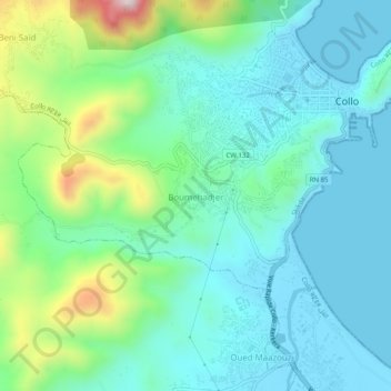
Name: Boumehadjer topographic map, elevation, terrain.
Location: Boumehadjer, Collo, Collo District, Skikda, 21210, Algeria (36.97688 6.53063 37.01688 6.57063)
Average elevation: 117 m
Minimum elevation: -1 m
Maximum elevation: 507 m