
Thank you for supporting this site ❤️
Make a donation
Make a donation
Gear up for your next adventure:
As an Amazon Associate, this site earns from qualifying purchases at no extra cost to you.
Cairani topographic map
Click on the map to display elevation.
Thank you for supporting this site ❤️
Make a donation
Make a donation
Gear up for your next adventure:
As an Amazon Associate, this site earns from qualifying purchases at no extra cost to you.
About this map
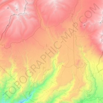
Name: Cairani topographic map, elevation, terrain.
Location: Cairani, Provincia de Candarave, Tacna, Perú (-17.34738 -70.43725 -17.04263 -70.28708)
Average elevation: 4,022 m
Minimum elevation: 2,142 m
Maximum elevation: 5,518 m
Thank you for supporting this site ❤️
Make a donation
Make a donation
Gear up for your next adventure:
As an Amazon Associate, this site earns from qualifying purchases at no extra cost to you.