
Thank you for supporting this site ❤️
Make a donation
Make a donation
Gear up for your next adventure:
As an Amazon Associate, this site earns from qualifying purchases at no extra cost to you.
Zurumbeneo topographic map
Click on the map to display elevation.
Thank you for supporting this site ❤️
Make a donation
Make a donation
Gear up for your next adventure:
As an Amazon Associate, this site earns from qualifying purchases at no extra cost to you.
About this map
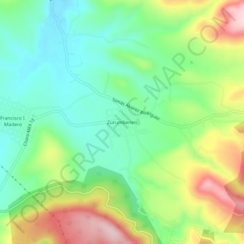
Name: Zurumbeneo topographic map, elevation, terrain.
Location: Zurumbeneo, Charo, Michoacán, Mexico (19.67987 -101.03097 19.71987 -100.99097)
Average elevation: 2,029 m
Minimum elevation: 1,928 m
Maximum elevation: 2,202 m
Thank you for supporting this site ❤️
Make a donation
Make a donation
Gear up for your next adventure:
As an Amazon Associate, this site earns from qualifying purchases at no extra cost to you.