
Horseshoe Bend National Military Park topographic map
Interactive map
Click on the map to display elevation.
About this map
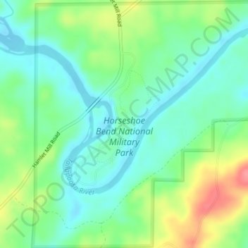
Name: Horseshoe Bend National Military Park topographic map, elevation, terrain.
Average elevation: 186 m
Minimum elevation: 160 m
Maximum elevation: 238 m
Other topographic maps
Click on a map to view its topography, its elevation and its terrain.
Alexander City
United States > Alabama > Tallapoosa County
Alexander City, Tallapoosa County, Alabama, 35010, United States
Average elevation: 188 m
Camp Hill
United States > Alabama > Tallapoosa County > Camp Hill > Camp Hill
Camp Hill, Tallapoosa County, Alabama, 36850, United States
Average elevation: 203 m