
祁曼塔格乡 topographic map
Interactive map
Click on the map to display elevation.
About this map
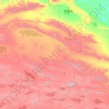
Name: 祁曼塔格乡 topographic map, elevation, terrain.
Location: 祁曼塔格乡, 若羌县, 巴音郭楞蒙古自治州, 新疆维吾尔自治区, 中国 (36.01741 87.36756 37.81256 91.31284)
Average elevation: 4,318 m
Minimum elevation: 2,687 m
Maximum elevation: 6,756 m
Other topographic maps
Click on a map to view its topography, its elevation and its terrain.