
Thank you for supporting this site ❤️
Make a donation
Make a donation
Gear up for your next adventure:
As an Amazon Associate, this site earns from qualifying purchases at no extra cost to you.
Ttutturre topographic map
Click on the map to display elevation.
Thank you for supporting this site ❤️
Make a donation
Make a donation
Gear up for your next adventure:
As an Amazon Associate, this site earns from qualifying purchases at no extra cost to you.
About this map
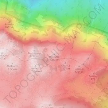
Name: Ttutturre topographic map, elevation, terrain.
Location: Ttutturre, Araiz, Larraun-Leitzaldea, Navarra, 31891, España (42.99157 -1.99033 42.99167 -1.99023)
Average elevation: 1,009 m
Minimum elevation: 431 m
Maximum elevation: 1,299 m
Thank you for supporting this site ❤️
Make a donation
Make a donation
Gear up for your next adventure:
As an Amazon Associate, this site earns from qualifying purchases at no extra cost to you.