
Villa Jiménez topographic map
Interactive map
Click on the map to display elevation.
About this map
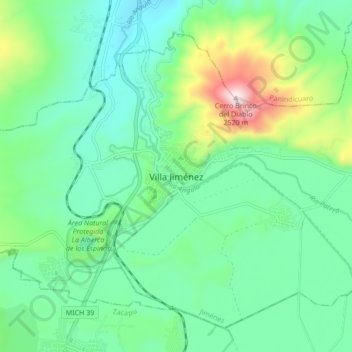
Name: Villa Jiménez topographic map, elevation, terrain.
Location: Villa Jiménez, Jiménez, Michoacán, México (19.88252 -101.78674 19.96252 -101.70674)
Average elevation: 2,024 m
Minimum elevation: 1,850 m
Maximum elevation: 2,538 m
Other topographic maps
Click on a map to view its topography, its elevation and its terrain.