Geolocate

Ulwe topographic map

Click on the map to display elevation.

About this map

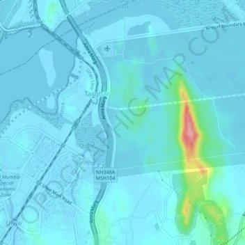
Name: Ulwe topographic map, elevation, terrain.

Location: Ulwe, Raigad, Maharashtra, 400614, India (18.96711 73.02039 19.00711 73.06039)

Average elevation: 10 m

Minimum elevation: -5 m

Maximum elevation: 128 m

Gear up for your next adventure:

Lightweight Tents - Compact tents for backpacking and trekking
🎿Telescopic Trekking Poles - Reduces knee strain on steep topographic descents
🔥Emergency Fire Starters - Reliable ignition tools for survival situations in damp conditions
🧢Waterproof Hiking Hats - Keep the rain off your face while studying topographic maps
🍱Food Containers - Reusable containers for outdoor meals

As an Amazon Associate, this site earns from qualifying purchases at no extra cost to you.