
Lac Gravel topographic map
Interactive map
Click on the map to display elevation.
About this map
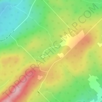
Name: Lac Gravel topographic map, elevation, terrain.
Average elevation: 550 m
Minimum elevation: 467 m
Maximum elevation: 643 m
Other topographic maps
Click on a map to view its topography, its elevation and its terrain.
Lac Racine
Canada > Québec > Sainte-Sabine
Lac Racine, Rang Sainte-Marie, Sainte-Sabine, Les Etchemins, Chaudière-Appalaches, Québec, Canada
Average elevation: 451 m