
Agua Caliente Grande (De Gastélum) topographic map
Interactive map
Click on the map to display elevation.
About this map
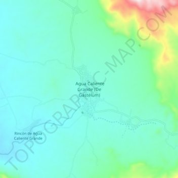
Name: Agua Caliente Grande (De Gastélum) topographic map, elevation, terrain.
Location: Agua Caliente Grande (De Gastélum), Choix, Sinaloa, Mexico (26.49878 -108.38796 26.57878 -108.30796)
Average elevation: 338 m
Minimum elevation: 211 m
Maximum elevation: 934 m