
Glattalpsee topographic map
Interactive map
Click on the map to display elevation.
About this map
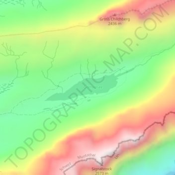
Name: Glattalpsee topographic map, elevation, terrain.
Location: Glattalpsee, Muotathal, Schwyz, 6436, Schweiz (46.91758 8.89636 46.92119 8.90955)
Average elevation: 2,063 m
Minimum elevation: 1,636 m
Maximum elevation: 2,577 m
Der Glattalpsee hat eine Fläche von 27,6 Hektar und befindet sich auf einer Höhe von 1853 m ü. M. Obwohl noch auf dem östlichen Schwyzer Kantonsgebiet liegend, gehört die Region bereits zu den Glarner Alpen. Gespiesen wird der See durch den Glattalpseebach, den Hinter Läckibach und den Vorderer Läckibach.