
Borgo San Pietro topographic map
Interactive map
Click on the map to display elevation.
About this map
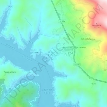
Name: Borgo San Pietro topographic map, elevation, terrain.
Location: Borgo San Pietro, Petrella Salto, Rieti, Latium, 02025, Italie (42.25259 13.04376 42.29259 13.08376)
Average elevation: 666 m
Minimum elevation: 526 m
Maximum elevation: 1,193 m