
Guática topographic map
Interactive map
Click on the map to display elevation.
About this map
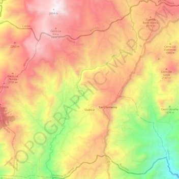
Name: Guática topographic map, elevation, terrain.
Location: Guática, Risaralda, Colombia (5.27007 -75.85987 5.38804 -75.74833)
Average elevation: 1,935 m
Minimum elevation: 1,226 m
Maximum elevation: 2,678 m
Other topographic maps
Click on a map to view its topography, its elevation and its terrain.