
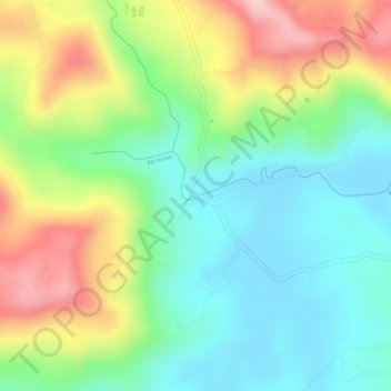
Rio Imbaú topographic map
Interactive map
Click on the map to display elevation.
About this map
Name: Rio Imbaú topographic map, elevation, terrain.
Average elevation: 863 m
Minimum elevation: 777 m
Maximum elevation: 995 m
Other topographic maps
Click on a map to view its topography, its elevation and its terrain.
Córrego Sete Saltos
Córrego Sete Saltos, Reserva, Microrregião Telêmaco Borba, Mesorregião Centro Oriental Paranaense, Paraná, Região Sul, Brasil
Average elevation: 731 m