
Yosemite Valley topographic map
Interactive map
Click on the map to display elevation.
About this map
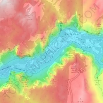
Name: Yosemite Valley topographic map, elevation, terrain.
Location: Yosemite Valley, Mariposa County, Californië, 95389, VS (37.69444 -119.64647 37.77444 -119.56647)
Average elevation: 1,953 m
Minimum elevation: 1,187 m
Maximum elevation: 2,736 m