
章子峰 topographic map
Interactive map
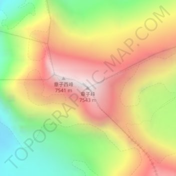
Click on the map to display elevation.
About this map
Name: 章子峰 topographic map, elevation, terrain.
Average elevation: 6,766 m
Minimum elevation: 5,995 m
Maximum elevation: 7,503 m
Other topographic maps
Click on a map to view its topography, its elevation and its terrain.
Siguang Ri
Siguang Ri, 扎西宗乡, དིང་རི་རྫོང་ / 定日县 / Tingri, གཞིས་ཀ་རྩེ་ས་ཁུལ་ / 日喀则市 / Shigatse, Tibet, China
Average elevation: 6,639 m