
Bedminster Township topographic map
Interactive map
Click on the map to display elevation.
About this map
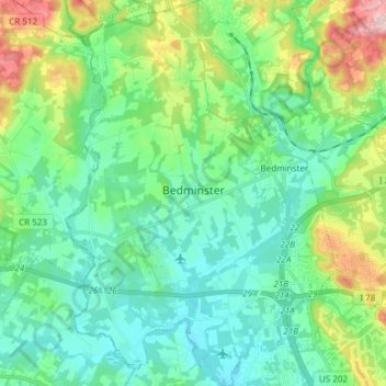
Name: Bedminster Township topographic map, elevation, terrain.
Average elevation: 80 m
Minimum elevation: 21 m
Maximum elevation: 255 m
Other topographic maps
Click on a map to view its topography, its elevation and its terrain.
Bridgewater Township
États-Unis d'Amérique > New Jersey > Somerset County
Bridgewater Township, Somerset County, New Jersey, États-Unis d'Amérique
Average elevation: 58 m
These Liberty Trees Monument & Park
États-Unis d'Amérique > New Jersey > Somerset County > Manville > Weston
These Liberty Trees Monument & Park, Weston, Manville, Somerset County, New Jersey, États-Unis d'Amérique
Average elevation: 17 m