
Aripi topographic map
Interactive map
Click on the map to display elevation.
About this map
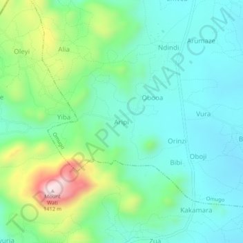
Name: Aripi topographic map, elevation, terrain.
Location: Aripi, Arua, Northern Region, Uganda (3.21888 31.02139 3.25888 31.06139)
Average elevation: 1,067 m
Minimum elevation: 946 m
Maximum elevation: 1,413 m