Geolocate

Tiffin topographic map

Click on the map to display elevation.

About this map

Name: Tiffin topographic map, elevation, terrain.

Location: Tiffin, Seneca County, Ohio, United States (41.08056 -83.22531 41.14587 -83.14960)

Average elevation: 235 m

Minimum elevation: 213 m

Maximum elevation: 248 m

Other topographic maps

Click on a map to view its topography, its elevation and its terrain.
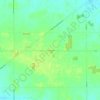
Frenchtown

United States > Ohio > Seneca County

Average elevation: 259 m

Gear up for your next adventure:

🥾Trekking Poles - Poles to improve stability on uneven terrain
🧘Folding Sit Mats - Dry and warm seat for map-reading breaks on damp ground
📱Rugged Phone Cases - Heavy-duty protection for smartphones used as secondary GPS tools
🍳Camping Stoves - Compact stoves for outdoor cooking
🧤Hiking Gloves - Warm and durable gloves for cold-weather walks

As an Amazon Associate, this site earns from qualifying purchases at no extra cost to you.