
Inom Vallgraven topographic map
Interactive map
Click on the map to display elevation.
About this map
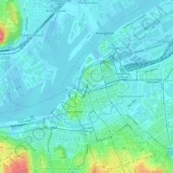
Name: Inom Vallgraven topographic map, elevation, terrain.
Average elevation: 13 m
Minimum elevation: -2 m
Maximum elevation: 76 m
Other topographic maps
Click on a map to view its topography, its elevation and its terrain.
Arendal
Suecia > Provincia de Västra Götaland > Gotemburgo
Arendal, Västra Hisingen, Gotemburgo, Göteborg, Provincia de Västra Götaland, Götaland, Suecia
Average elevation: 18 m
Södra Biskopsgården
Suecia > Provincia de Västra Götaland > Gotemburgo
Södra Biskopsgården, Västra Hisingen, Gotemburgo, Göteborg, Provincia de Västra Götaland, Götaland, Suecia
Average elevation: 40 m