
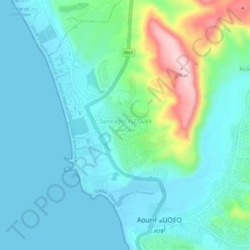
Tamraght topographic map
Interactive map
Click on the map to display elevation.
About this map
Name: Tamraght topographic map, elevation, terrain.
Average elevation: 55 m
Minimum elevation: -2 m
Maximum elevation: 268 m
Other topographic maps
Click on a map to view its topography, its elevation and its terrain.
Imi Miki
Maroc > cercle d'Agadir-Atlantique > Aourir
Imi Miki, Aourir, caïdat d'Aourir, cercle d'Agadir-Atlantique, Préfecture d'Agadir Ida-Outanane, Souss-Massa, 80750, Maroc
Average elevation: 161 m