
Tăul Ascuns topographic map
Interactive map
Click on the map to display elevation.
About this map
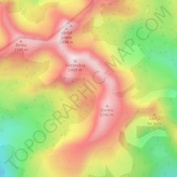
Name: Tăul Ascuns topographic map, elevation, terrain.
Location: Tăul Ascuns, Râu de Mori, Hunedoara, Roumanie (45.34845 22.85761 45.34909 22.85842)
Average elevation: 2,111 m
Minimum elevation: 1,787 m
Maximum elevation: 2,369 m
Other topographic maps
Click on a map to view its topography, its elevation and its terrain.
Râu de Mori
Roumanie > Hunedoara > Râu de Mori
Râu de Mori, Hunedoara, 337380, Roumanie
Average elevation: 541 m