
Make a donation
Gear up for your next adventure:
As an Amazon Associate, this site earns from qualifying purchases at no extra cost to you.
Kartarpur topographic map
Click on the map to display elevation.
Make a donation
Gear up for your next adventure:
As an Amazon Associate, this site earns from qualifying purchases at no extra cost to you.
Kartarpur
Kartarpur is located at 31°26′N 75°30′E / 31.44°N 75.5°E / 31.44; 75.5. It has an average elevation of 228 metres (748 feet). It is situated at a distance of 15 km from Jalandhar towards Amritsar on G.T. Road (National Highway 1).
Make a donation
Gear up for your next adventure:
As an Amazon Associate, this site earns from qualifying purchases at no extra cost to you.
About this map
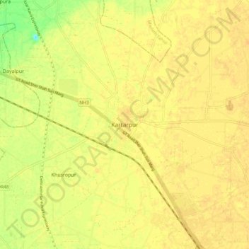
Name: Kartarpur topographic map, elevation, terrain.
Average elevation: 236 m
Minimum elevation: 217 m
Maximum elevation: 241 m
Make a donation
Gear up for your next adventure:
As an Amazon Associate, this site earns from qualifying purchases at no extra cost to you.