
Kühnhaide topographic map
Interactive map
Click on the map to display elevation.
About this map
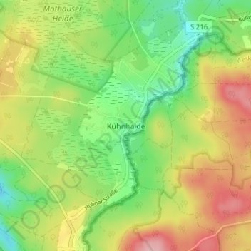
Name: Kühnhaide topographic map, elevation, terrain.
Location: Kühnhaide, Marienberg, Erzgebirgskreis, Saxony, 09496, Germany (50.56070 13.21343 50.60070 13.25343)
Average elevation: 760 m
Minimum elevation: 697 m
Maximum elevation: 838 m