Geolocate

Livezile topographic map

Click on the map to display elevation.

About this map

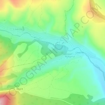
Name: Livezile topographic map, elevation, terrain.

Location: Livezile, Alba, Romania (46.33340 23.62331 46.35184 23.66489)

Average elevation: 379 m

Minimum elevation: 296 m

Maximum elevation: 531 m

Gear up for your next adventure:

📱Rugged Phone Cases - Heavy-duty protection for smartphones used as secondary GPS tools
📸Action Camera Chest Mounts - Record your ascent following topographic paths hands-free
🛰️Outdoor GPS Navigation - Navigation devices for remote and off-grid areas
🧊Insulated Flasks - Keeps drinks hot or cold during hikes
🕶️Polarized Sunglasses - Reduces glare from snow and water when reading terrain

As an Amazon Associate, this site earns from qualifying purchases at no extra cost to you.