Geolocate

Harrislee topographic map

Click on the map to display elevation.

About this map
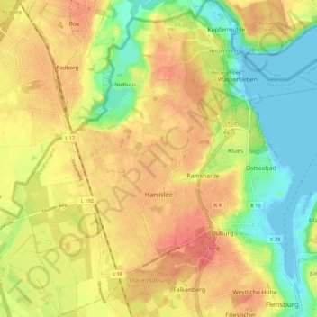
Name: Harrislee topographic map, elevation, terrain.

Location: Harrislee, Kreis Schleswig-Flensburg, Schleswig-Holstein, 24955, Germany (54.78123 9.34205 54.84261 9.42288)

Average elevation: 35 m

Minimum elevation: -2 m

Maximum elevation: 66 m

Other topographic maps

Click on a map to view its topography, its elevation and its terrain.

Gear up for your next adventure:

🔥Emergency Fire Starters - Reliable ignition tools for survival situations in damp conditions
👟Women's Trail Running Shoes - Agile footwear for fell running and technical trails
🖼️Topographic Map Art - Decorative 3D-effect posters of famous UK peaks and regions
📱Phone Mounts for Hiking - Secure mounts to carry your phone on trails
🛌Insulated Sleeping Mats - Crucial thermal protection when sleeping on cold, uneven ground

As an Amazon Associate, this site earns from qualifying purchases at no extra cost to you.