
New Haven topographic map
Interactive map
Click on the map to display elevation.
About this map
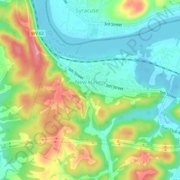
Name: New Haven topographic map, elevation, terrain.
Location: New Haven, Mason County, West Virginia, 25265, United States (38.97418 -81.98453 38.99626 -81.94872)
Average elevation: 204 m
Minimum elevation: 169 m
Maximum elevation: 262 m
Other topographic maps
Click on a map to view its topography, its elevation and its terrain.