
Mount Mansfield topographic map
Interactive map
Click on the map to display elevation.
Mount Mansfield
Mount Mansfield is the highest mountain in Vermont, reaching an elevation of 4,393 feet (1,339 m) above sea level. Located in the northwest of the state, it is also the highest peak in the Green Mountains. Its summit is located within the town of Underhill in Chittenden County; the ridgeline, including some secondary peaks, extends into the town of Stowe in Lamoille County, and the mountain's flanks also reach into the town of Cambridge.
About this map
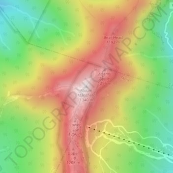
Name: Mount Mansfield topographic map, elevation, terrain.
Average elevation: 914 m
Minimum elevation: 505 m
Maximum elevation: 1,333 m