
Totogalpa topographic map
Interactive map
Click on the map to display elevation.
About this map
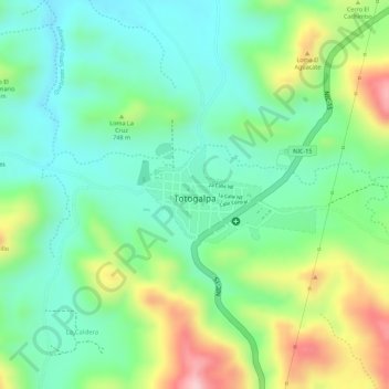
Name: Totogalpa topographic map, elevation, terrain.
Location: Totogalpa, Totogalpa (Municipio), Madriz, 35300, Nicaragua (13.55979 -86.49639 13.56658 -86.48411)
Average elevation: 712 m
Minimum elevation: 630 m
Maximum elevation: 860 m
Other topographic maps
Click on a map to view its topography, its elevation and its terrain.