
Paipa topographic map
Interactive map
Click on the map to display elevation.
About this map
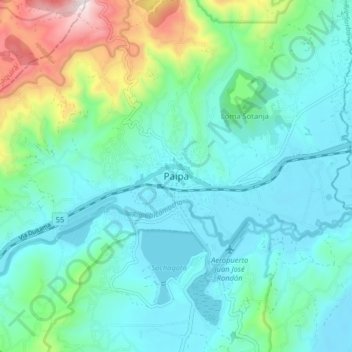
Name: Paipa topographic map, elevation, terrain.
Location: Paipa, Tundama, Boyacá, 150440, Colombia (5.74128 -73.15765 5.82128 -73.07765)
Average elevation: 2,641 m
Minimum elevation: 2,477 m
Maximum elevation: 3,263 m
Other topographic maps
Click on a map to view its topography, its elevation and its terrain.