Geolocate

Total topographic map

Interactive map

Click on the map to display elevation.

About this map

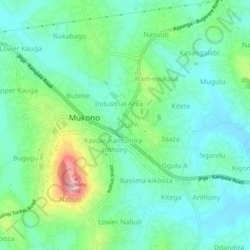
Name: Total topographic map, elevation, terrain.

Location: Total, Mukono, Central Region, Uganda (0.33967 32.73257 0.37967 32.77257)

Average elevation: 1,188 m

Minimum elevation: 1,135 m

Maximum elevation: 1,335 m

Other topographic maps

Click on a map to view its topography, its elevation and its terrain.

Nkonge

Uganda > Mukono

Average elevation: 1,166 m

Mayangayanga

Uganda > Mukono

Average elevation: 1,126 m

Kwaba

Uganda > Mukono

Average elevation: 1,118 m

Namakwa

Uganda > Mukono

Average elevation: 1,169 m

Buwujja-mbeya

Uganda > Mukono > Buwujja-mbeya

Average elevation: 1,149 m