
Gurupura topographic map
Interactive map
Click on the map to display elevation.
About this map
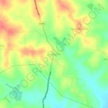
Name: Gurupura topographic map, elevation, terrain.
Location: Gurupura, Hunasuru taluk, Mysuru, Karnataka, India (12.18845 76.26230 12.22845 76.30230)
Average elevation: 775 m
Minimum elevation: 742 m
Maximum elevation: 811 m