
Thank you for supporting this site ❤️
Make a donation
Make a donation
Gear up for your next adventure:
As an Amazon Associate, this site earns from qualifying purchases at no extra cost to you.
Parmandal topographic map
Click on the map to display elevation.
Thank you for supporting this site ❤️
Make a donation
Make a donation
Gear up for your next adventure:
As an Amazon Associate, this site earns from qualifying purchases at no extra cost to you.
About this map
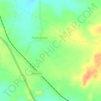
Name: Parmandal topographic map, elevation, terrain.
Location: Parmandal, Multai Tahsil, Betul, Madhya Pradesh, India (21.78631 78.22737 21.81717 78.26399)
Average elevation: 767 m
Minimum elevation: 748 m
Maximum elevation: 790 m
Thank you for supporting this site ❤️
Make a donation
Make a donation
Gear up for your next adventure:
As an Amazon Associate, this site earns from qualifying purchases at no extra cost to you.