Geolocate

Rayne topographic map

Click on the map to display elevation.

About this map

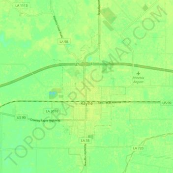
Name: Rayne topographic map, elevation, terrain.

Location: Rayne, Acadia Parish, Louisiana, 70578, United States (30.21890 -92.29985 30.26551 -92.21027)

Average elevation: 9 m

Minimum elevation: -3 m

Maximum elevation: 13 m

Other topographic maps

Click on a map to view its topography, its elevation and its terrain.

Frey

United States > Louisiana > Acadia Parish

Average elevation: 12 m

Mowata

United States > Louisiana > Acadia Parish

Average elevation: 12 m

Gear up for your next adventure:

🥤Collapsible Water Bottles - Save space in your rucksack as you consume your water
🌄Outdoor Binoculars - Compact binoculars for landscape observation
🧼Technical Clothing Wash - Special soap to clean and restore waterproof membranes
🍱Food Containers - Reusable containers for outdoor meals
🔋Lithium AA Batteries - Long-lasting power that performs well in cold mountain weather

As an Amazon Associate, this site earns from qualifying purchases at no extra cost to you.