Geolocate

Lower Engadin topographic map

Click on the map to display elevation.

About this map

Name: Lower Engadin topographic map, elevation, terrain.

Location: Lower Engadin, Engiadina Bassa/Val Müstair, Grisons, Switzerland (46.65034 10.02975 46.89287 10.47425)

Average elevation: 2,281 m

Minimum elevation: 1,052 m

Maximum elevation: 3,366 m

Other topographic maps

Click on a map to view its topography, its elevation and its terrain.
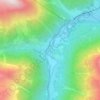
Susch

Switzerland > Grisons > Engiadina Bassa/Val Müstair

Average elevation: 1,865 m

Gear up for your next adventure:

🗺️Ordnance Survey Maps - Essential paper maps for hiking across the UK national parks
📍Handheld GPS Navigators - Reliable satellite navigation for hiking and off-road exploration
🧥Softshell Jackets - Breathable jackets for active outdoor use
🧺Ultralight Dry Bags - Organize and waterproof your gear inside your rucksack
🧼Technical Clothing Wash - Special soap to clean and restore waterproof membranes

As an Amazon Associate, this site earns from qualifying purchases at no extra cost to you.