Geolocate

Salian topographic map

Click on the map to display elevation.

About this map

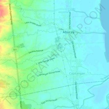
Name: Salian topographic map, elevation, terrain.

Location: Salian, Abucay, Bataan, Central Luzon, 2114, Philippines (14.69304 120.50958 14.73304 120.54958)

Average elevation: 14 m

Minimum elevation: -1 m

Maximum elevation: 63 m

Gear up for your next adventure:

🛌Sleeping Bags - Warm and packable sleeping bags for outdoor nights
Camping Shelters - Emergency and lightweight shelters for outdoor use
🌂Windproof Trekking Umbrellas - Surprising but effective rain protection on low-wind trails
🧢Waterproof Hiking Hats - Keep the rain off your face while studying topographic maps
🛰️Handheld GPS Devices - Reliable GPS units for hiking and outdoor navigation

As an Amazon Associate, this site earns from qualifying purchases at no extra cost to you.