Geolocate

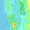
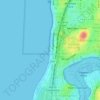
Subiaco topographic map

Click on the map to display elevation.

About this map

Name: Subiaco topographic map, elevation, terrain.

Location: Subiaco, Perth, Western Australia, 6008, Australia (-31.95645 115.80798 -31.94082 115.84174)

Average elevation: 33 m

Minimum elevation: -1 m

Maximum elevation: 72 m

Other topographic maps

Click on a map to view its topography, its elevation and its terrain.
Canning river

Australia > Western Australia > Perth

Average elevation: 293 m

Lake Claremont

Australia > Western Australia > Perth

Average elevation: 22 m

Reabold Hill

Australia > Western Australia > Perth

Average elevation: 32 m

Mundaring Weir

Australia > Western Australia > Perth

Average elevation: 185 m

Adenia Lagoon

Australia > Western Australia > Perth

Average elevation: 9 m

Lake Gwelup

Australia > Western Australia > Perth

Average elevation: 25 m

Mosman Beach

Australia > Western Australia > Perth

Average elevation: 9 m

Woodford Park

Australia > Western Australia > Perth

Average elevation: 11 m

Hatfield Park

Australia > Western Australia > Perth

Average elevation: 24 m

Brittania Reserve

Australia > Western Australia > Perth

Average elevation: 25 m

Alderley Park

Australia > Western Australia > Perth

Average elevation: 10 m

Bold Park

Australia > Western Australia > Perth

Average elevation: 34 m

Gear up for your next adventure:

🧺Ultralight Dry Bags - Organize and waterproof your gear inside your rucksack
👕Merino Base Layers - Natural temperature regulation for cold weather hiking and camping
🦯Walking Poles - Supportive poles for long-distance walking
🔋Lithium AA Batteries - Long-lasting power that performs well in cold mountain weather
📱Phone Mounts for Hiking - Secure mounts to carry your phone on trails

As an Amazon Associate, this site earns from qualifying purchases at no extra cost to you.