

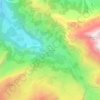
Kiental topographic map
Click on the map to display elevation.
Kiental
Since 1910, the nearby mountain of Niesen (altitude 2,362 m [7,749 ft]) can be ascended at gradients of up to 68% via the Niesenbahn, which with a length of 3,499 m (11,480 ft) is the longest funicular railway in Europe.
About this map

Name: Kiental topographic map, elevation, terrain.
Average elevation: 1,509 m
Minimum elevation: 714 m
Maximum elevation: 2,495 m
Other topographic maps
Click on a map to view its topography, its elevation and its terrain.
Griesalp
Switzerland > Bern > Frutigen-Niedersimmental administrative district > Reichenbach im Kandertal
Average elevation: 1,730 m