
湘江 topographic map
Interactive map
Click on the map to display elevation.
About this map
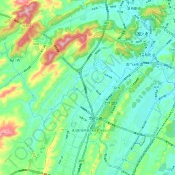
Name: 湘江 topographic map, elevation, terrain.
Location: 湘江, 遵义市, 贵州省, 中国 (27.63908 106.82445 27.67978 106.94097)
Average elevation: 910 m
Minimum elevation: 805 m
Maximum elevation: 1,200 m
Other topographic maps
Click on a map to view its topography, its elevation and its terrain.