Geolocate

Huby topographic map

Interactive map

Click on the map to display elevation.

About this map

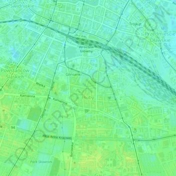
Name: Huby topographic map, elevation, terrain.

Location: Huby, Wrocław, Lower Silesian Voivodeship, Poland (51.08297 17.02498 51.09892 17.04945)

Average elevation: 124 m

Minimum elevation: 118 m

Maximum elevation: 130 m

Other topographic maps

Click on a map to view its topography, its elevation and its terrain.

Wrocław

Poland > Lower Silesian Voivodeship > Wroclaw

Wrocław, Trzebnica County, Lower Silesian Voivodeship, Poland

Average elevation: 125 m

Osiedle Muchobór Wielki

Poland > Lower Silesian Voivodeship > Wroclaw

Osiedle Muchobór Wielki, Wroclaw, Wrocław, Lower Silesian Voivodeship, Poland

Average elevation: 121 m