
Ogden topographic map
Interactive map
Click on the map to display elevation.
About this map
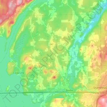
Name: Ogden topographic map, elevation, terrain.
Location: Ogden, Memphrémagog, Estrie, Québec, Canada (45.00473 -72.25190 45.08647 -72.09593)
Average elevation: 253 m
Minimum elevation: 167 m
Maximum elevation: 424 m
Other topographic maps
Click on a map to view its topography, its elevation and its terrain.
Orford
Canada > Québec > Memphrémagog
Orford, Memphrémagog, Estrie, Québec, Canada
Average elevation: 319 m